


LERN - Camarenilla
Located in Toledo, Spain
ICAO - , IATA -
Data provided by AirmateGeneral information
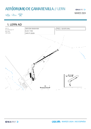
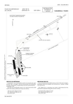
Coordinates: N40°1'33" W4°4'8"
Elevation is 1765 feet MSL.
Magnetic variation is -1° East View others Airports in Castilla-La Mancha
Operational data
Special qualification required
Current time UTC:
Current local time:
Weather at : LEGT - Madrid/Getafe ( 42 km )
METAR: LEGT 161230Z 25008KT 210V320 9999 BKN049 17/03 Q1010
TAF: TAF LEGT 161100Z 1612/1712 24010KT 9999 SCT045 TX21/1615Z TN09/1705Z TEMPO 1612/1620 24015G25KT PROB40 TEMPO 1704/1710 4000 RA SHRA BKN008 SCT030TCU
Communications frequencies: [VIEW]
Runways:
| RWY identifier | QFU | Length (ft) | Width (ft) | Surface | LDA (ft) |
| 05 | 0° | 1640 | 66 | DIRT | |
| 23 | 0° | 1640 | 66 | DIRT | |
| 06 | 60° | 1228 | 40 | UNKN | |
| 24 | 240° | 1228 | 40 | UNKN |
Airport contact information
Address: Toledo Spain