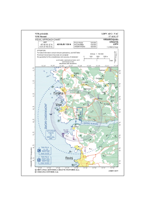


LDPV - Vrsar / Crljenka
Located in Vrsar, Croatia
ICAO - LDPV, IATA -
Data provided by AirmateGeneral information
Coordinates: N45°8'30" E13°37'50"
Elevation is 138 feet MSL.
Magnetic variation is 4° East View others Airports in Istria
Operational data
Special qualification required
Current time UTC:
Current local time:
Weather at : LDPL - Pula ( 36 km )
METAR: LDPL 131330Z 12003KT 070V150 9999 FEW045 22/11 Q1015 NOSIG
TAF: TAF LDPL 131125Z 1312/1412 13006KT 9999 FEW040 TX21/1313Z TN14/1403Z BECMG 1400/1402 06010KT PROB30 TEMPO 1406/1412 SHRA FEW030TCU
Communications frequencies: [VIEW]
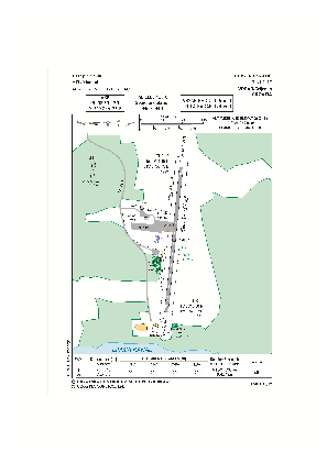
Runways:
| RWY identifier | QFU | Length (ft) | Width (ft) | Surface | LDA (ft) |
| 18 | 184° | 2260 | 49 | ASPH | 2300 |
| 36 | 4° | 2260 | 49 | ASPH | 2300 |
Airport contact information
Address: Vrsar Croatia
