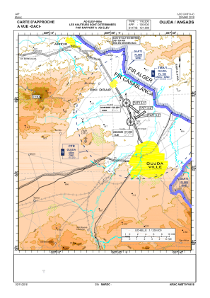
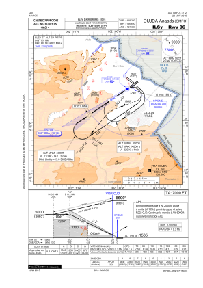
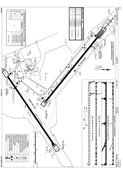


GMFO - Oujda/Angads
Located in Oujda, Morocco
ICAO - GMFO, IATA - OUD
Data provided by AirmateGeneral information
Coordinates: N34°47'10" W1°55'32"
Elevation is 1535 feet MSL.
Magnetic variation is 1° East View others Airports in Oujda
Operational data
Special qualification required
Current time UTC:
Current local time:
Weather
METAR: GMFO 281230Z 01012KT 9999 SCT020/// BKN033/// 15/10 Q1012 NOSIG
TAF: TAF GMFO 281100Z 2812/2918 04014KT 9999 SCT020 NKN060 PROB30 TEMPO 2817/2908 8000 SHRA
Communications frequencies: [VIEW]
Runways:
| RWY identifier | QFU | Length (ft) | Width (ft) | Surface | LDA (ft) |
| 06 | 58° | 9790 | 138 | ASPH | 9843 |
| 24 | 238° | 9790 | 138 | ASPH | 9843 |
| 13 | 131° | 9800 | 145 | ASPH | 9843 |
| 31 | 311° | 9800 | 145 | ASPH | 9843 |
Airport contact information
Address: Oujda Morocco