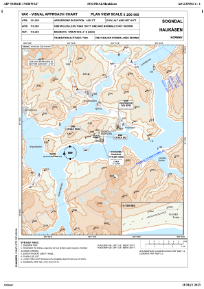

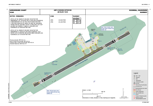


ENSG - Haukaasen
Located in Sogndal, Norway
ICAO - ENSG, IATA - SOG
Data provided by AirmateGeneral information
Coordinates: N61°9'22" E7°8'16"
Elevation is 1633 feet MSL.
Magnetic variation is 2.2° East View others Airports in Sogn og Fjordane
Operational data
Special qualification required
Current time UTC:
Current local time:
Weather
METAR: ENSG 161250Z 07007KT 030V100 CAVOK 21/04 Q1019 RMK WIND 3806FT 11018KT
TAF: TAF ENSG 161100Z 1612/1621 07005KT CAVOK PROB30 1612/1621 25010KT
Communications frequencies: [VIEW]
Runways:
| RWY identifier | QFU | Length (ft) | Width (ft) | Surface | LDA (ft) |
| 06 | 0° | 3642 | 98 | UNK | |
| 24 | 0° | 3642 | 98 | UNK |
Airport contact information
Address: Sogndal Norway