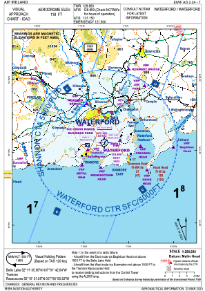
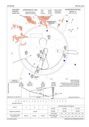
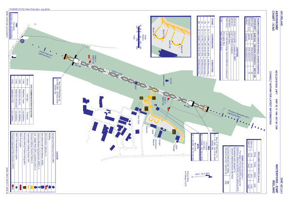


EIWF - Waterford
Located in Waterford, Ireland
ICAO - EIWF, IATA - WAT
Data provided by AirmateGeneral information
Coordinates: N52°11'14" W7°5'13"
Elevation is 119 feet MSL.
Magnetic variation is -3° East View others Airports in County Waterford
Operational data
Special qualification required
Current time UTC:
Current local time:
Weather
TAF: TAF EIWF 122300Z 1300/1309 21009KT 9999 BKN010 TEMPO 1300/1304 4000 BR BKN005 BECMG 1303/1305 14010KT TEMPO 1303/1306 4000 -RA BKN008 BECMG 1306/1308 13015G25KT 4000 -RA BKN008 TEMPO 1306/1309 12020G30KT 2500 RA BKN004
Communications frequencies: [VIEW]
Runways:
| RWY identifier | QFU | Length (ft) | Width (ft) | Surface | LDA (ft) |
| 03 | 21° | 4701 | 98 | ASPH | 4406 |
| 21 | 201° | 4701 | 98 | ASPH | 4232 |
Airport contact information
Address: Waterford Ireland
