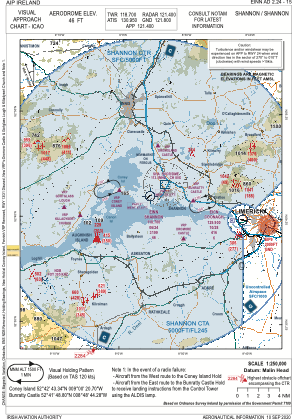
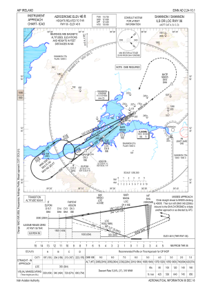
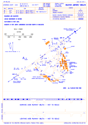


EINN - Shannon
Located in Limerick, Ireland
ICAO - EINN, IATA - SNN
Data provided by AirmateGeneral information
Coordinates: N52°42'7" W8°55'29"
Elevation is 46 feet MSL.
Magnetic variation is -4° East View others Airports in County Clare
Operational data
Special qualification required
Current time UTC:
Current local time:
Weather
METAR: EINN 122300Z 02005KT 9999 FEW020 BKN040 12/09 Q1004 NOSIG
TAF: TAF EINN 122300Z 1300/1324 VRB03KT 9999 SCT020 BKN025 BECMG 1302/1304 11013KT TEMPO 1304/1315 4000 -RA BKN012 PROB40 TEMPO 1305/1313 11015G25KT 2500 RA BKN008 BECMG 1313/1315 16009KT BECMG 1321/1323 VRB03KT
Communications frequencies: [VIEW]
Runways:
| RWY identifier | QFU | Length (ft) | Width (ft) | Surface | LDA (ft) |
| 06 | 52° | 10495 | 148 | ASPH | 10495 |
| 24 | 232° | 10495 | 148 | ASPH | 10036 |
Airport contact information
Address: Limerick Ireland
