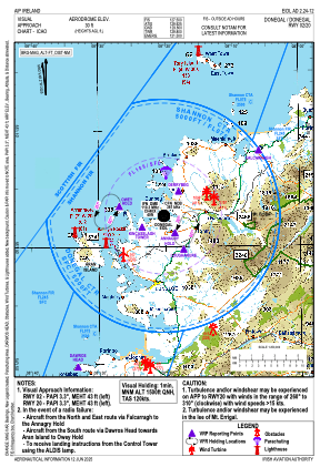
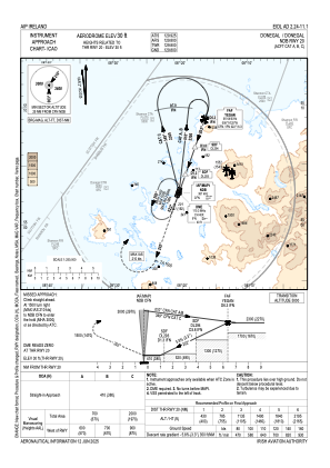
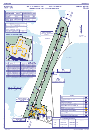


EIDL - Donegal
Located in Donegal Town, Ireland
ICAO - EIDL, IATA - CFN
Data provided by AirmateGeneral information
Coordinates: N55°2'39" W8°20'28"
Elevation is 31 feet MSL.
Magnetic variation is -2.85° East View others Airports in County Donegal
Operational data
Special qualification required
Current time UTC:
Current local time:
Weather
METAR: EIDL 091600Z 01007KT CAVOK 14/09 Q1023
TAF: TAF EIDL 091400Z 0915/0924 30010KT 9999 FEW025 BECMG 0915/0917 VRB03KT BECMG 0921/0923 17010KT
Communications frequencies: [VIEW]
Runways:
| RWY identifier | QFU | Length (ft) | Width (ft) | Surface | LDA (ft) |
| 03 | 20° | 4908 | 98 | ASPH | 3799 |
| 21 | 200° | 4908 | 98 | ASPH | 3950 |
Airport contact information
Address: Donegal Town Ireland