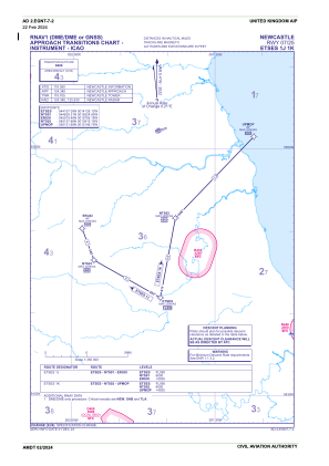
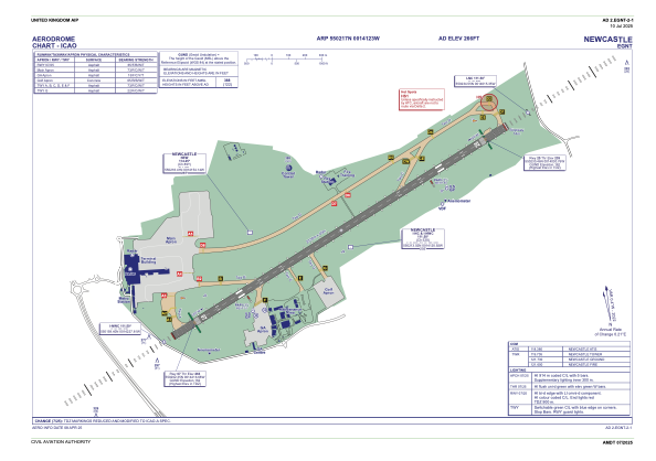


EGNT - Newcastle
Located in Newcastle-Upon-Tyne, United Kingdom
ICAO - EGNT, IATA - NCL
Data provided by AirmateGeneral information
Coordinates: N55°2'17" W1°41'23"
Elevation is 266 feet MSL.
View others Airports in England
Operational data
Special qualification required
Current time UTC:
Current local time:
Weather
METAR: EGNT 112320Z 16004KT 120V190 CAVOK 10/09 Q1019
TAF: TAF EGNT 112303Z 1200/1224 10005KT 9999 FEW045 TEMPO 1200/1209 3000 BR BKN002 PROB30 TEMPO 1200/1207 0300 FG BKN000 PROB30 TEMPO 1220/1224 6000 SHRA
Communications frequencies: [VIEW]
Runways:
| RWY identifier | QFU | Length (ft) | Width (ft) | Surface | LDA (ft) |
| 07 | 65° | 7644 | 148 | ASP | |
| 25 | 245° | 7644 | 148 | ASP |
Airport contact information
Address: Newcastle-Upon-Tyne United Kingdom
Handlers

Other aviation service providers
Flight schools

Northumbria Flying School Limited
Northumbria Flying School Limited
ian@flyingintheuk.co.uk+44 020813970