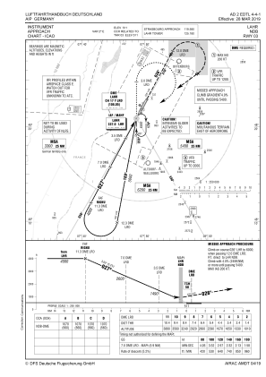
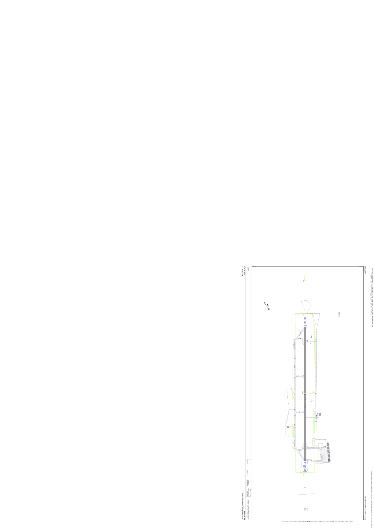


EDTL - Lahr
Located in Lahr, Germany
ICAO - EDTL, IATA - LHA
Data provided by AirmateGeneral information
Coordinates: N48°22'9" E7°49'40"
Elevation is 511 feet MSL.
Magnetic variation is 1.6000° East View others Airports in Baden-Württemberg
Operational data
Special qualification required
Current time UTC:
Current local time:
Weather
METAR: EDTL 151850Z AUTO 26008KT 230V320 9999 // FEW017/// BKN037/// BKN048/// 16/14 Q1004
TAF: TAF EDTL 151700Z 1518/1524 02009KT 9999 SCT020 BKN035 BECMG 1518/1521 17005KT TEMPO 1518/1524 SHRA SCT015 BKN025TCU PROB40 TEMPO 1518/1524 4000 TSRA BKN013 BKN020CB
Communications frequencies: [VIEW]
Runways:
| RWY identifier | QFU | Length (ft) | Width (ft) | Surface | LDA (ft) |
| 03 | 28° | 9843 | 148 | CONC | 9843 |
| 21 | 208° | 9843 | 148 | CONC | 9843 |
Airport contact information
Address: Lahr Germany
