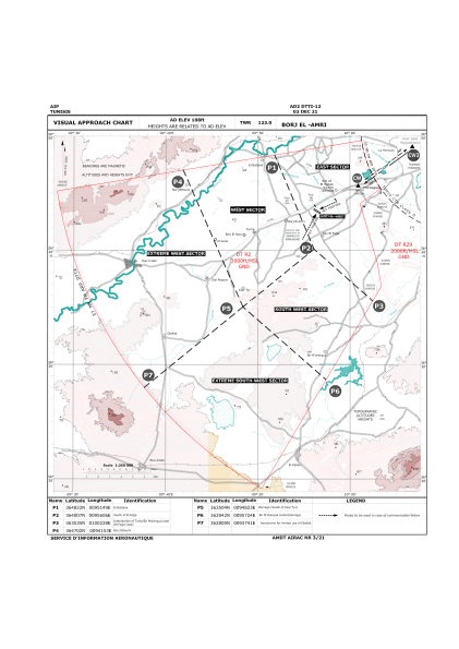
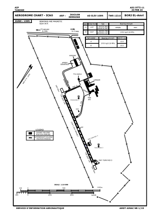


DTTI - Borj-El Amri
Located in Tunis, Tunisia
ICAO - DTTI, IATA -
Data provided by AirmateGeneral information
Coordinates: N36°43'16" E9°56'36"
Elevation is 109 feet MSL.
Magnetic variation is 3° East View others Airports in Ben Arous Governorate
Operational data
Special qualification required
Current time UTC:
Current local time:
Weather at : DTTA - Tunis/Carthage ( 29 km )
METAR: DTTA 161600Z 33012KT 290V360 9999 FEW023 26/10 Q1009
TAF: TAF DTTA 161100Z 1612/1712 32010KT 9999 SCT023
Communications frequencies: [VIEW]
Runways:
| RWY identifier | QFU | Length (ft) | Width (ft) | Surface | LDA (ft) |
| 12 | 126° | 3609 | 98 | UNK | |
| 30 | 306° | 3609 | 98 | UNK |
Airport contact information
Address: Tunis Tunisia