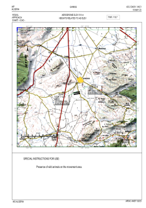
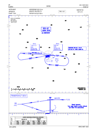
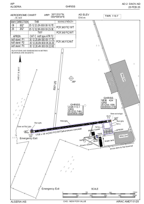


DAOV - Ghriss
Located in Ghriss, Algeria
ICAO - DAOV, IATA - MUW
Data provided by AirmateGeneral information
Coordinates: N35°13'1" E0°8'54"
Elevation is 1686 feet MSL.
View others Airports in Mascara Province
Operational data
Special qualification required
Current time UTC:
Current local time:
Weather
METAR: DAOV 181500Z 33010KT 9999 FEW030 BKN233 24/11 Q1011
TAF: TAF DAOV 181400Z 1815/1824 34011KT 9999 FEW030 BKN233 PROB30 TEMPO 1815/1820 5000 -TSRA FEW026CB
Communications frequencies: [VIEW]
Runways:
| RWY identifier | QFU | Length (ft) | Width (ft) | Surface | LDA (ft) |
| 08 | 82° | 5577 | 98 | ASP | |
| 26 | 262° | 5577 | 98 | ASP |
Airport contact information
Address: Ghriss Algeria