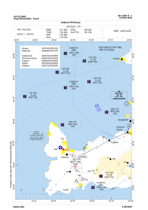
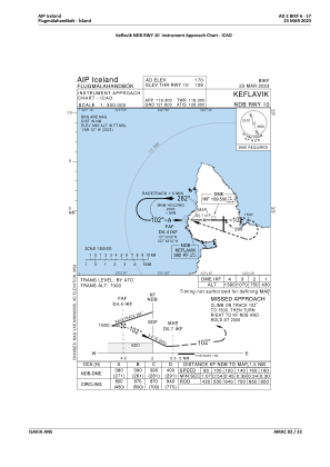
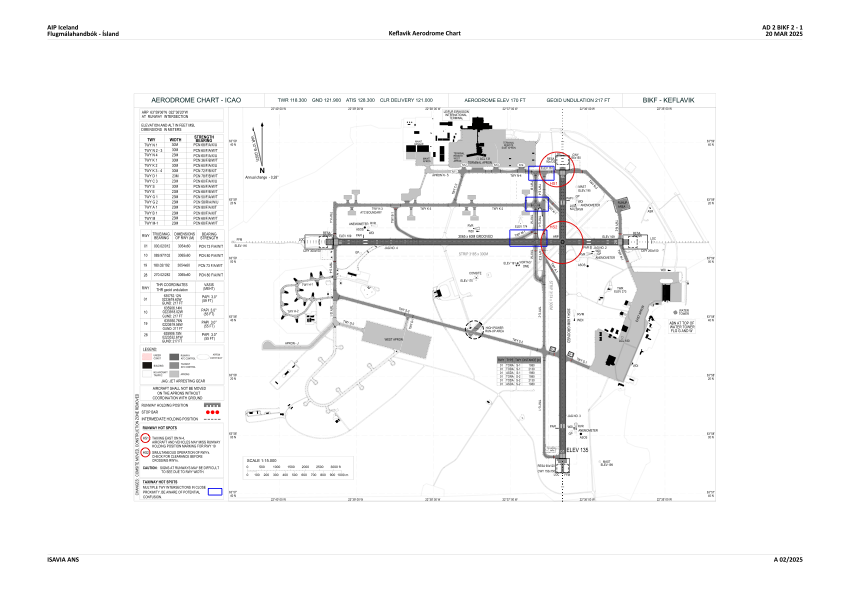


BIKF - Keflavik
Located in Keflavik, Iceland
ICAO - BIKF, IATA - KEF
Data provided by AirmateGeneral information
Coordinates: N63°59'6" W22°36'20"
Elevation is 170 feet MSL.
View others Airports in Southern Peninsula
Operational data
Special qualification required
Current time UTC:
Current local time:
Weather
METAR: BIKF 101500Z 10017KT 9999 VCSH OVC011 09/08 Q1001
TAF: TAF BIKF 101325Z 1015/1115 07012KT 9999 OVC028 TX10/1115Z TN07/1109Z TEMPO 1015/1018 4000 SHRA BKN014 OVC022 BECMG 1016/1018 13014KT 7000 RADZ OVC014 TEMPO 1018/1109 2000 RADZ BR OVC005 BECMG 1109/1111 9999 -SHRA SCT016 BKN024
Communications frequencies: [VIEW]
Runways:
| RWY identifier | QFU | Length (ft) | Width (ft) | Surface | LDA (ft) |
| 01 | 0° | 10020 | 197 | ASPH | |
| 19 | 180° | 10020 | 197 | ASPH | |
| 10 | 90° | 10056 | 197 | ASPH | |
| 28 | 270° | 10056 | 197 | ASPH |
Airport contact information
Address: Keflavik Iceland