


7S8 - Ross Intl
Located in Sweetgrass, United States
ICAO - 7S8, IATA -
Data provided by AirmateGeneral information
Coordinates: N48°59'55" W111°58'42"
Elevation is 3553 feet MSL.
Magnetic variation is 18° East View others Airports in Montana
Operational data
Special qualification required
Current time UTC:
Current local time:
Weather at : KCTB - Cut Bank Intl ( 52 km )
METAR: KCTB 081308Z AUTO 33027G39KT 2 1/2SM -SN BR BKN009 OVC013 01/01 A3000 RMK AO2 PK WND 33039/1306 P0000 T00060006
TAF: KCTB 081141Z 0812/0912 34025G35KT 3SM -SN BR SCT008 BKN015 TEMPO 0812/0816 1SM -SN BR OVC008 FM081600 34020G30KT 6SM -SNRA SCT010 OVC015 TEMPO 0816/0818 3SM -RASN BR BKN010 FM081800 35015G25KT P6SM SCT012 BKN020 FM090200 33009KT P6SM SCT015 BKN030
Communications frequencies: [VIEW]
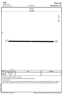
Runways:
| RWY identifier | QFU | Length (ft) | Width (ft) | Surface | LDA (ft) |
| 07 | 91° | 2900 | 80 | GRASS | |
| 25 | 271° | 2900 | 80 | GRASS |
Airport contact information
Address: Sweetgrass United States