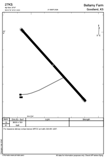


27KS - Bellamy Farm
Located in Goodland, United States
ICAO - 27KS, IATA -
Data provided by AirmateGeneral information
Coordinates: N39°7'49" W101°42'50"
Elevation is 3707 feet MSL.
Magnetic variation is 09° East View others Airports in Kansas
Operational data
Special qualification required
Current time UTC:
Current local time:
Weather at : KGLD - Renner Fld/Goodland Muni ( 27 km )
METAR: KGLD 081453Z AUTO 34014KT 10SM OVC100 11/M06 A2970 RMK AO2 SLP036 T01111061 50004
TAF: KGLD 081120Z 0812/0912 29011KT P6SM FEW250 FM081400 30017G27KT P6SM FEW250 FM090100 32010KT P6SM FEW250
Communications frequencies: [VIEW]
Runways:
| RWY identifier | QFU | Length (ft) | Width (ft) | Surface | LDA (ft) |
| 13 | 138° | 3000 | 150 | GRASS | |
| 31 | 318° | 3000 | 150 | GRASS |
Airport contact information
Address: Goodland United States