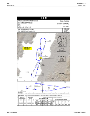
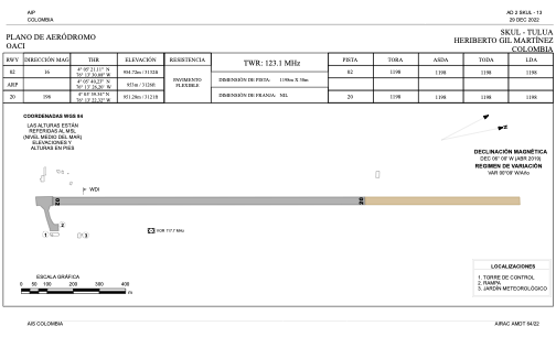


SKUL - Heriberto Gil Martinez
Located in Tulu, Colombia
ICAO - SKUL, IATA - ULQ
Data provided by AirmateGeneral information
Coordinates: N4°5'40" W76°13'26"
Elevation is 3132 feet MSL.
Magnetic variation is -6° East View others Airports in Valle del Cauca
Operational data
Special qualification required
Current time UTC:
Current local time:
Weather at : SKCL - Alfonso Bonilla Aragon ( 64 km )
METAR: SKCL 071500Z 27003KT 9999 SCT020 27/21 Q1018 NOSIG
TAF: TAF SKCL 071030Z 0712/0812 VRB02KT 9999 FEW023 SCT120 TEMPO 0721/0801 32012KT SCT020TCU TX29/0720Z TN20/0811Z
Communications frequencies: [VIEW]
Runways:
| RWY identifier | QFU | Length (ft) | Width (ft) | Surface | LDA (ft) |
| 02 | 12° | 3930 | 98 | PAVE | 3930 |
| 20 | 192° | 3930 | 98 | PAVE | 3930 |
Airport contact information
Address: Tulu Colombia