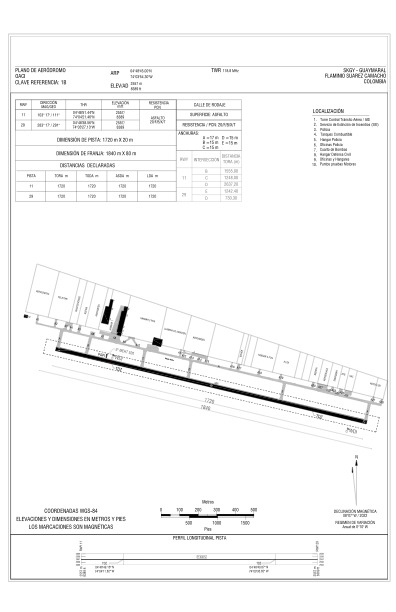


SKGY - Guaymaral - Flaminio Suarez Camacho
Located in Chia, Colombia
ICAO - SKGY, IATA -
Data provided by AirmateGeneral information
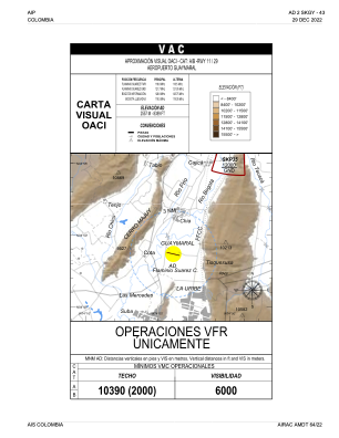
Coordinates: N4°48'45" W74°3'54"
Elevation is 8389 feet MSL.
Magnetic variation is -8° East View others Airports in Cundinamarca
Operational data
Special qualification required
Current time UTC:
Current local time:
Weather at : SKBO - El Dorado ( 15 km )
TAF: TAF SKBO 031030Z 0312/0412 VRB03KT 9999 SCT020 BECMG 0316/0318 15012KT TEMPO 0319/0322 TSRA BKN015CB BECMG 0402/0404 VRB02KT PROB40 TEMPO 0403/0408 DZRA BKN015 TX22/0318Z TN11/0410Z
Communications frequencies: [VIEW]
Runways:
| RWY identifier | QFU | Length (ft) | Width (ft) | Surface | LDA (ft) |
| 11 | 103° | 5643 | 65 | ASPH | 5643 |
| 29 | 283° | 5643 | 65 | ASPH | 5643 |
Airport contact information
Address: Chia Colombia