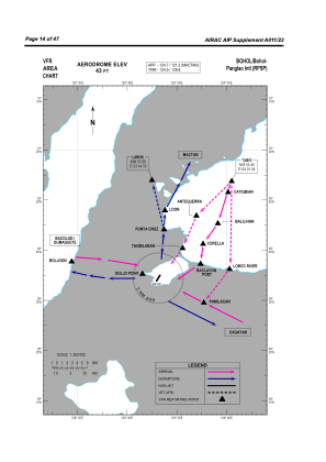
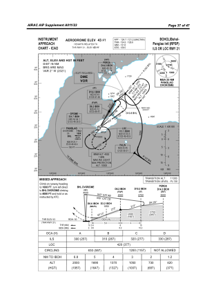
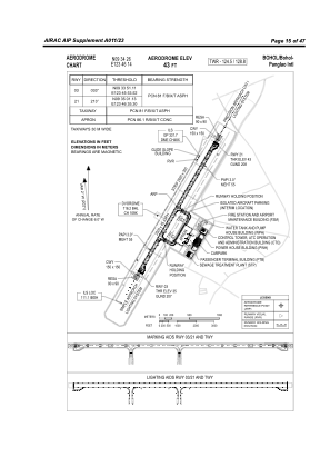


RPSP - Bohol-Panglao Airport
Located in Bohol, Philippines
ICAO - , IATA -
Data provided by AirmateGeneral information
Coordinates: N9°34'26" E123°46'14"
Elevation is 42 feet MSL.
Magnetic variation is -2° East View others Airports in Bohol
Operational data
Special qualification required
Current time UTC:
Current local time:
Weather at : RPVD - Dumaguete Principal Airport (Class 1) ( 58 km )
TAF: TAF RPVD 231100Z 2312/2412 29005KT 9999 FEW015 SCT070 TEMPO 2315/2321 -SHRA SCT014 BKN070 BECMG 2322/2324 05009KT 8000 -RA SCT015 OVC070 TEMPO 2404/2410 07014KT 5000 TSRA SCT014CB OVC070
Communications frequencies: [VIEW]
Runways:
| RWY identifier | QFU | Length (ft) | Width (ft) | Surface | LDA (ft) |
| 03 | 31° | 8596 | 148 | ASPH | 8202 |
| 21 | 211° | 8596 | 148 | ASPH | 8202 |
Airport contact information
Address: Bohol Philippines