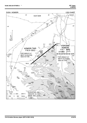
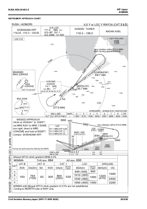
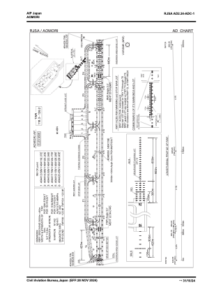


RJSA - Aomori
Located in Aomori, Japan
ICAO - RJSA, IATA - AOJ
Data provided by AirmateGeneral information
Coordinates: N40°44'0" E140°41'19"
Elevation is 650 feet MSL.
View others Airports in Aomori Prefecture
Operational data
Special qualification required
Current time UTC:
Current local time:
Weather
METAR: RJSA 290700Z 26017G27KT 9999 FEW015 SCT020 13/08 Q1009
TAF: TAF RJSA 290512Z 2906/3012 24010KT 9999 FEW020
Communications frequencies: [VIEW]
Runways:
| RWY identifier | QFU | Length (ft) | Width (ft) | Surface | LDA (ft) |
| 06 | 52° | 9843 | 197 | ASP | |
| 24 | 232° | 9843 | 197 | ASP |
Airport contact information
Address: Aomori Japan