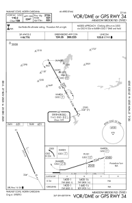


N63 - Meadow Brook Fld
Located in Walnut Cove, United States
ICAO - N63, IATA -
Data provided by AirmateGeneral information
Coordinates: N36°18'5" W80°8'54"
Elevation is 631 feet MSL.
Magnetic variation is -06° East View others Airports in North Carolina
Operational data
Special qualification required
Current time UTC:
Current local time:
Weather at : KINT - Smith Reynolds ( 20 km )
METAR: KINT 031154Z 24003KT 7SM -RA OVC007 21/18 A3007 RMK AO2 RAB23 SLP171 P0002 60002 70067 T02060183 10206 20194 51012
TAF: KINT 031140Z 0312/0412 22006KT 6SM -RA BKN006 BKN015 OVC080 TEMPO 0312/0313 P6SM NSW OVC005 FM031330 22006KT P6SM VCSH BKN012 FM031500 22007KT P6SM SCT030 PROB30 0321/0403 VRB15G25KT 2SM TSRA SCT025 BKN040CB OVC090 FM040900 23003KT 6SM BR BKN006
Communications frequencies: [VIEW]
Runways:
| RWY identifier | QFU | Length (ft) | Width (ft) | Surface | LDA (ft) |
| 16 | 160° | 2725 | 32 | ASPH | |
| 34 | 340° | 2725 | 32 | ASPH |
Airport contact information
Address: Walnut Cove United States