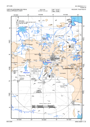
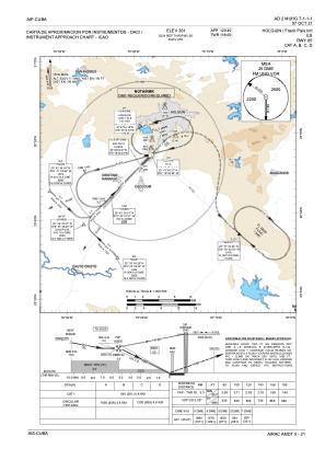
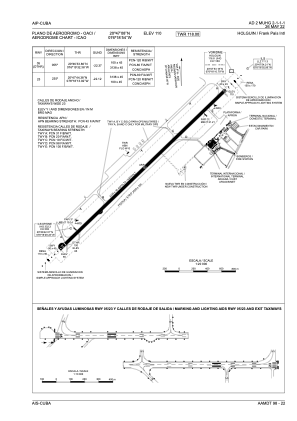


MUHG - Holguin/Frank Pais Intl
Located in Holguin, Cuba
ICAO - MUHG, IATA - HOG
Data provided by AirmateGeneral information
Coordinates: N20°47'8" W76°18'54"
Elevation is 361 feet MSL.
View others Airports in Holguín
Operational data
Special qualification required
Current time UTC:
Current local time:
Weather
TAF: MUHG 011100Z 0112/0212 VRB04KT 9000 SCT020 TEMPO 0116/0124 VRB10KT 5000 TSRA SCT018CB BKN020
Communications frequencies: [VIEW]
Runways:
| RWY identifier | QFU | Length (ft) | Width (ft) | Surface | LDA (ft) |
| 05 | 46° | 10623 | 148 | ASP | |
| 23 | 226° | 10623 | 148 | ASP |
Airport contact information
Address: Holguin Cuba