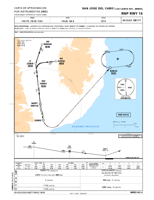
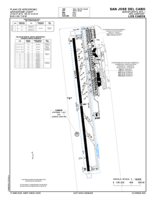


MMSD - San Jose Del Cabo Aeropuerto Internacional Los Cabos
Located in San Jose Del Cabo, Mexico
ICAO - MMSD, IATA - SJD
Data provided by AirmateGeneral information
Coordinates: N23°9'7" W109°43'15"
Elevation is 381 feet MSL.
View others Airports in Baja California Sur
Operational data
Special qualification required
Current time UTC:
Current local time:
Communications frequencies: [VIEW]
Runways:
| RWY identifier | QFU | Length (ft) | Width (ft) | Surface | LDA (ft) |
| 16 | 173° | 9856 | 148 | ASP | |
| 34 | 353° | 9856 | 148 | ASP |
Airport contact information
Address: San Jose Del Cabo Mexico