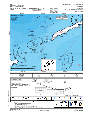
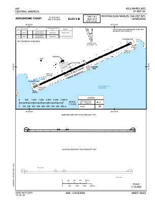


MHRO - Juan Manuel Galvez
Located in Roatan, Honduras
ICAO - MHRO, IATA - RTB
Data provided by AirmateGeneral information
Coordinates: N16°19'2" W86°31'20"
Elevation is 20 feet MSL.
View others Airports in Islas de la Bahia
Operational data
Special qualification required
Current time UTC:
Current local time:
Weather
METAR: MHRO 072300Z 10008KT 9999 FEW030 30/26 Q1008 A2977 NOSIG
TAF: TAF MHRO 072250Z 0800/0824 12012KT 9999 FEW025 SCT080 TX32/0819Z TN28/0812Z
Communications frequencies: [VIEW]
Runways:
| RWY identifier | QFU | Length (ft) | Width (ft) | Surface | LDA (ft) |
| 07 | 65° | 6854 | 148 | ASP | |
| 25 | 245° | 6854 | 148 | ASP |
Airport contact information
Address: Roatan Honduras