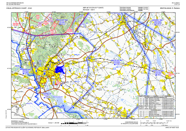
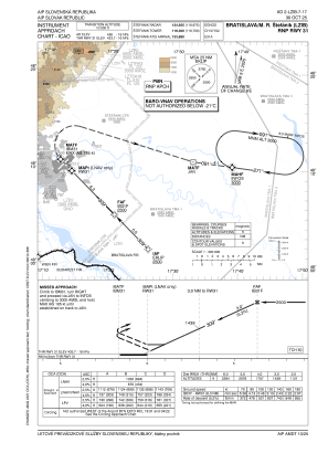
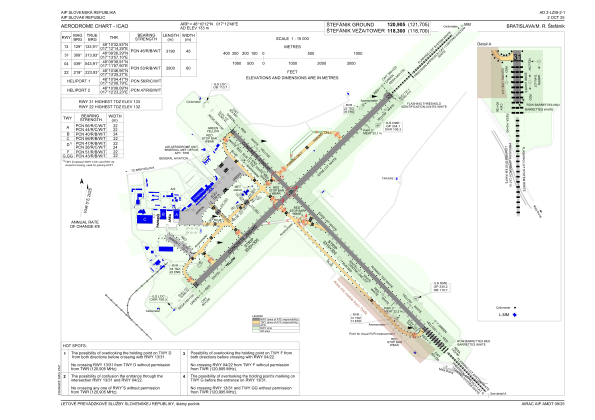


LZIB - Bratislava/M. R. Stefanik
Located in Bratislava, Slovakia
ICAO - LZIB, IATA - BTS
Data provided by AirmateGeneral information
Coordinates: N48°10'12" E17°12'46"
Elevation is 436 feet MSL.
Magnetic variation is 4.8531° East View others Airports in Bratislava
Operational data
Special qualification required
Current time UTC:
Current local time:
Weather
TAF: TAF LZIB 231115Z 2312/2412 31007KT 9999 FEW040 BECMG 2318/2320 04008KT TEMPO 2403/2412 -SHRA SCT020CB BKN025 PROB40 TEMPO 2403/2412 2500 TSRA
Communications frequencies: [VIEW]
Runways:
| RWY identifier | QFU | Length (ft) | Width (ft) | Surface | LDA (ft) |
| 13 | 134° | 10466 | 148 | CONC | 10466 |
| 31 | 314° | 10466 | 148 | CONC | 9678 |
| 04 | 44° | 9514 | 197 | CONC | 9514 |
| 22 | 224° | 9514 | 197 | CONC | 9514 |
Airport contact information
Address: Bratislava Slovakia
