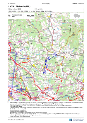
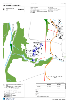


LKTH - Techonin
Located in Techonin, Czech Republic
ICAO - , IATA -
Data provided by AirmateGeneral information
Coordinates: N50°3'37" E16°36'44"
Elevation is 1679 feet MSL.
View others Airports in Pardubice Region
Operational data
Special qualification required
Current time UTC:
Current local time:
Weather at : LKPD - Pardubice ( 63 km )
METAR: LKPD 231830Z 07004KT CAVOK 20/11 Q1015 NOSIG RMK BLU BLU
TAF: TAF LKPD 231700Z 2318/2418 10004KT CAVOK TEMPO 2402/2418 11008KT 7000 SHRA BKN020TCU PROB40 TEMPO 2408/2414 17012KT 4000 TSRA BKN018CB
Communications frequencies: [VIEW]
Runways:
Airport contact information
Address: Techonin Czech Republic