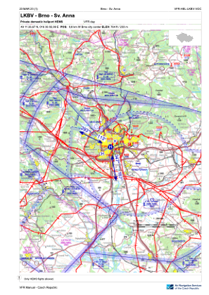
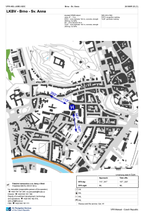


LKBV - Brno - Sv. Anna
Located in Brno, Czech Republic
ICAO - , IATA -
Data provided by AirmateGeneral information
Coordinates: N49°11'27" E16°36'3"
Elevation is 764 feet MSL.
View others Airports in South Moravian Region
Operational data
Special qualification required
Current time UTC:
Current local time:
Weather at : LKTB - Brno/Turany ( 8 km )
METAR: LKTB 070430Z VRB02KT 9999 VCSH FEW045 16/14 Q1016 NOSIG
TAF: TAF LKTB 062300Z 0700/0800 VRB02KT 9999 SCT040 TEMPO 0700/0706 3000 MIFG BR SCT003 PROB40 TEMPO 0700/0705 6000 TSRA SCT035CB BECMG 0707/0709 19010KT TEMPO 0710/0718 30015KT 7000 SHRA SCT030CB BECMG 0718/0720 VRB02KT
Communications frequencies: [VIEW]
Runways:
Airport contact information
Address: Brno Czech Republic