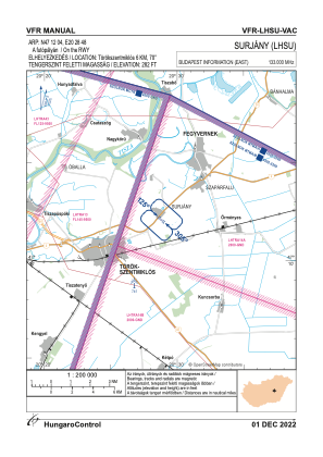
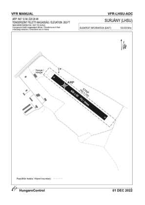


LHSU - Surjany
Located in Surjany, Hungary
ICAO - , IATA -
Data provided by AirmateGeneral information
Coordinates: N47°12'4" E20°28'48"
Elevation is 282 feet MSL.
View others Airports in Jász-Nagykun-Szolnok
Operational data
Special qualification required
Current time UTC:
Current local time:
Weather at : LHSN - Szolnok ( 20 km )
METAR: LHSN 230345Z 22004KT 5000 BR NSC 16/15 Q1012 BECMG 6000 NSW RMK WHT
TAF: TAF LHSN 230215Z 2303/2312 30004KT 9999 FEW002 SCT060 TEMPO 2303/2305 VRB02KT 6000 SCT002 SCT060 TEMPO 2305/2309 33006KT CAVOK BECMG 2308/2310 9999 SCT020 PROB30 TEMPO 2310/2312 29009KT 8000 -SHRA SCT033TCU BKN040
Communications frequencies: [VIEW]
Runways:
| RWY identifier | QFU | Length (ft) | Width (ft) | Surface | LDA (ft) |
| 13 | 0° | 1969 | 164 | GRASS | |
| 31 | 0° | 1969 | 164 | GRASS |
Airport contact information
Address: Surjany Hungary