
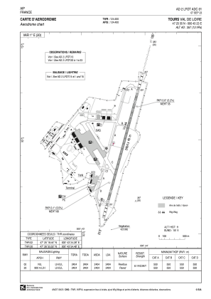


LFOT - Tours Val De Loire
Located in Tours, France
ICAO - LFOT, IATA - TUF
Data provided by AirmateGeneral information
Coordinates: N47°25'55" E0°43'23"
Elevation is 357 feet MSL.
Magnetic variation is 0.61° East View others Airports in Centre
Operational data
Special qualification required
Current time UTC:
Current local time:
Weather
METAR: LFOT 152230Z AUTO 22012KT 9999 FEW026 SCT041 BKN047 14/11 Q1011 NOSIG
TAF: TAF LFOT 151700Z 1518/1618 24014KT 9999 BKN045 TEMPO 1518/1520 23015G30KT -SHRA BKN040TCU BECMG 1602/1604 -RA BKN011 TEMPO 1606/1609 4500 -RADZ BKN009 BECMG 1609/1611 SCT020 BKN040
Communications frequencies: [VIEW]
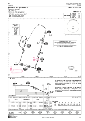
Runways:
| RWY identifier | QFU | Length (ft) | Width (ft) | Surface | LDA (ft) |
| 02 | 15° | 7887 | 148 | CONC | 7887 |
| 20 | 195° | 7887 | 148 | CONC | 7887 |
Airport contact information
Address: Tours France


