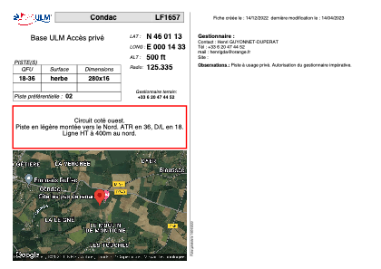


LF1657 - Condac
Located in Condac, France
ICAO - , IATA -
Data provided by AirmateGeneral information
Coordinates: N46°1'13" E0°14'33"
Elevation is 500 feet MSL.
View others Airports in Poitou-Charentes
Operational data
Special qualification required
Current time UTC:
Current local time:
Weather at : LFBU - Angouleme Brie Champniers ( 32 km )
TAF: TAF LFBU 291100Z 2912/3012 22010KT 9999 BKN020 TEMPO 2912/3006 3000 RA BKN005 TEMPO 2921/3004 1000 RADZ BKN002 PROB40 TEMPO 3006/3007 BKN007
Communications frequencies: [VIEW]
Runways:
| RWY identifier | QFU | Length (ft) | Width (ft) | Surface | LDA (ft) |
| 18 | 0° | 918 | 52 | GRASS | |
| 36 | 0° | 918 | 52 | GRASS |
Airport contact information
Address: Condac France