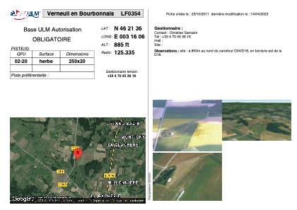


LF0354 - Verneuil en Bourbonnais
Located in Verneuil-en-Boubonnais, France
ICAO - , IATA -
Data provided by AirmateGeneral information
Coordinates: N46°21'36" E3°16'6"
Elevation is 885 feet MSL.
View others Airports in Auvergne
Operational data
Special qualification required
Current time UTC:
Current local time:
Weather at : LFLV - Vichy Charmeil ( 23 km )
METAR: LFLV 291030Z AUTO VRB05KT 9999 FEW035 OVC100 19/11 Q1017
Communications frequencies: [VIEW]
Runways:
| RWY identifier | QFU | Length (ft) | Width (ft) | Surface | LDA (ft) |
| 02 | 0° | 820 | 65 | GRASS | |
| 20 | 0° | 820 | 65 | GRASS |
Airport contact information
Address: Verneuil-en-Boubonnais France