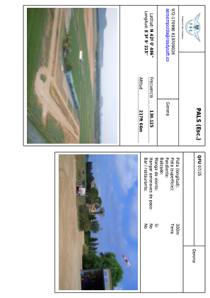


LEPALS - PALS
Located in Fontclara, Spain
ICAO - , IATA -
Data provided by AirmateGeneral information
Coordinates: N42°0'23" E3°9'6"
Elevation is 217 feet MSL.
Magnetic variation is 2° East View others Airports in Girona
Operational data
Special qualification required
Current time UTC:
Current local time:
Weather at : LEGE - Girona ( 34 km )
METAR: LEGE 171400Z 17018KT 9999 FEW035 26/17 Q1012 NOSIG
TAF: TAF LEGE 171100Z 1712/1812 18012KT CAVOK TX28/1714Z TN16/1806Z TEMPO 1713/1717 18015G25KT BECMG 1719/1721 VRB04KT PROB30 TEMPO 1720/1806 2000 BR BKN010
Communications frequencies: [VIEW]
Runways:
| RWY identifier | QFU | Length (ft) | Width (ft) | Surface | LDA (ft) |
| 07 | 70° | 993 | 40 | DIRT | |
| 25 | 250° | 993 | 40 | DIRT | |
| 16 | 161° | 718 | 38 | DIRT | |
| 34 | 341° | 718 | 38 | DIRT |
Airport contact information
Address: Fontclara Spain