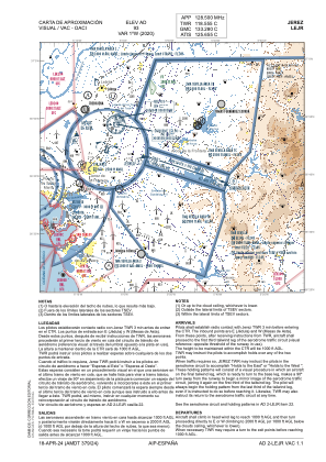
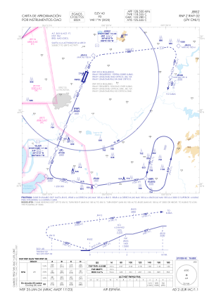
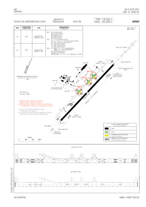


LEJR - Jerez
Located in Jerez De La Frontera, Spain
ICAO - LEJR, IATA - XRY
Data provided by AirmateGeneral information
Coordinates: N36°44'41" W6°3'36"
Elevation is 93 feet MSL.
Magnetic variation is -1° East View others Airports in Andalucía
Operational data
Special qualification required
Current time UTC:
Current local time:
Weather
METAR: LEJR 182030Z 25007KT 9999 SCT016 20/16 Q1016
TAF: TAF LEJR 182000Z 1821/1921 22010KT 9999 FEW030 TX22/1914Z TN14/1906Z BECMG 1821/1824 VRB04KT BECMG 1906/1908 25010KT PROB40 TEMPO 1906/1918 4000 SHRA FEW030CB PROB30 TEMPO 1912/1918 3000 TSRA SCT025CB
Communications frequencies: [VIEW]
Runways:
| RWY identifier | QFU | Length (ft) | Width (ft) | Surface | LDA (ft) |
| 02 | 21° | 7516 | 148 | ASPH | 7546 |
| 20 | 201° | 7516 | 148 | ASPH | 7546 |
Airport contact information
Address: Jerez De La Frontera Spain


