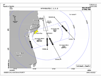

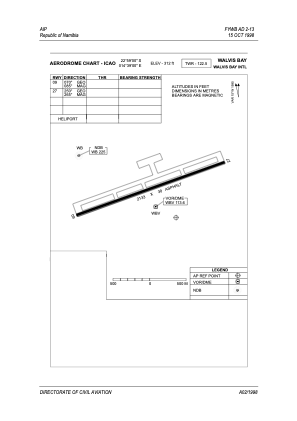


FYWB - Walvis Bay
Located in Walvis Bay, Namibia
ICAO - FYWB, IATA - WVB
Data provided by AirmateGeneral information
Coordinates: S22°58'48" E14°38'43"
Elevation is 299 feet MSL.
View others Airports in Erongo
Operational data
Special qualification required
Current time UTC:
Current local time:
Weather
TAF: TAF FYWB 311600Z 3118/0118 26013KT CAVOK BECMG 3120/3122 06005KT 9999 BKN012 TEMPO 0100/0104 00000KT 0700 FG OVC007 BECMG 0107/0109 04005KT 9999 NSW BKN012
Communications frequencies: [VIEW]
Runways:
| RWY identifier | QFU | Length (ft) | Width (ft) | Surface | LDA (ft) |
| 09 | 72° | 11286 | 197 | ASP | |
| 27 | 252° | 11286 | 197 | ASP |
Airport contact information
Address: Walvis Bay Namibia