


EYPA - Palanga/International
Located in Palanga, Lithuania
ICAO - EYPA, IATA - PLQ
Data provided by AirmateGeneral information
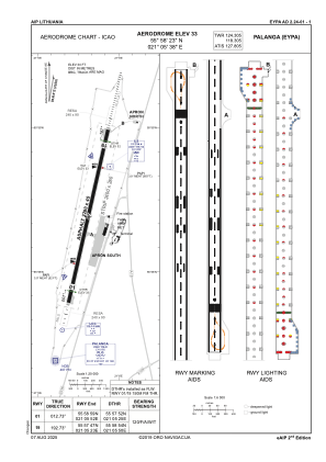
Coordinates: N55°58'23" E21°5'38"
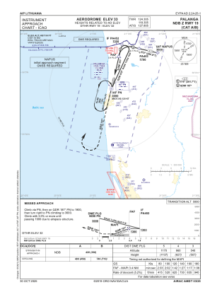
Elevation is 33 feet MSL.
Magnetic variation is 6° East View others Airports in Klaipeda County
Operational data
Special qualification required
Current time UTC:
Current local time:
Weather
METAR: EYPA 010950Z VRB02KT CAVOK 23/15 Q1012
TAF: TAF EYPA 010509Z 0106/0206 VRB05KT 9000 FEW035 TEMPO 0109/0112 TS SCT030CB TEMPO 0112/0118 VRB20G30KT 1500 TSRA BKN020CB TEMPO 0118/0120 TS SCT030CB BECMG 0120/0121 5000 MIFG BR TEMPO 0121/0204 0300 FG VV002
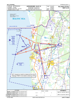
Communications frequencies: [VIEW]
Runways:
| RWY identifier | QFU | Length (ft) | Width (ft) | Surface | LDA (ft) |
| 01 | 13° | 7480 | 148 | CONC+ASPH | 6988 |
| 19 | 193° | 7480 | 148 | CONC+ASPH | 6988 |
Airport contact information
Address: Palanga Lithuania