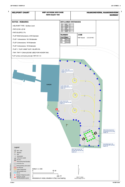


ENBH - Haakonsvern
Located in Bergen, Norway
ICAO - , IATA -
Data provided by AirmateGeneral information
Coordinates: N60°19'59" E5°13'40"
Elevation is 190 feet MSL.
Magnetic variation is 1.4° East View others Airports in Hordaland
Operational data
Special qualification required
Current time UTC:
Current local time:
Weather at : ENBR - Flesland ( 4 km )
METAR: ENBR 071520Z 16010KT 110V180 9999 FEW025TCU SCT030 12/06 Q1007 TEMPO TSRA BKN020CB RMK WIND 1200FT 14014KT
TAF: TAF ENBR 071100Z 0712/0812 16012KT 9999 -SHRA FEW015 SCT020TCU TEMPO 0712/0812 SHRA BKN020CB PROB40 TEMPO 0712/0714 TS TEMPO 0800/0812 4000 SHRA BKN012 SCT018CB
Communications frequencies: [VIEW]
Runways:
Airport contact information
Address: Bergen Norway