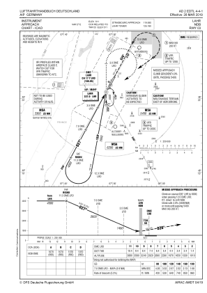
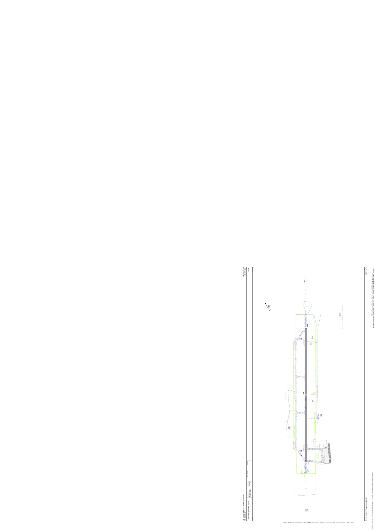


EDTL - Lahr
Located in Lahr, Germany
ICAO - EDTL, IATA - LHA
Data provided by AirmateGeneral information
Coordinates: N48°22'9" E7°49'40"
Elevation is 511 feet MSL.
Magnetic variation is 1.6000° East View others Airports in Baden-Württemberg
Operational data
Special qualification required
Current time UTC:
Current local time:
Weather
METAR: EDTL 290750Z 21008KT 180V240 9999 BKN043 17/12 Q1016
TAF: TAF EDTL 290746Z 2908/2915 21008KT 9999 FEW045 TEMPO 2910/2915 RA
Communications frequencies: [VIEW]
Runways:
| RWY identifier | QFU | Length (ft) | Width (ft) | Surface | LDA (ft) |
| 03 | 28° | 9843 | 148 | CONC | 9843 |
| 21 | 208° | 9843 | 148 | CONC | 9843 |
Airport contact information
Address: Lahr Germany
