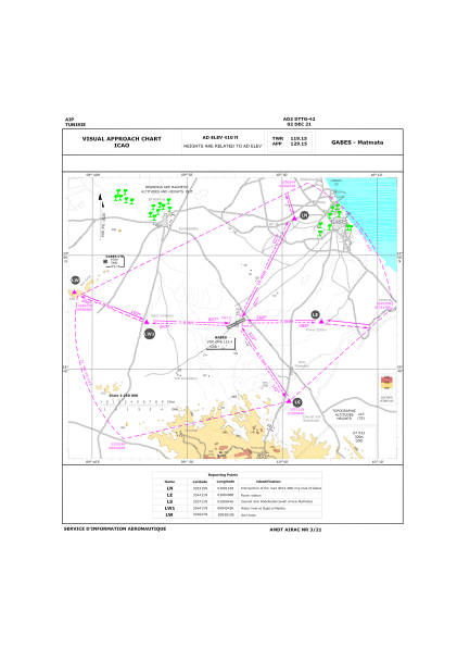
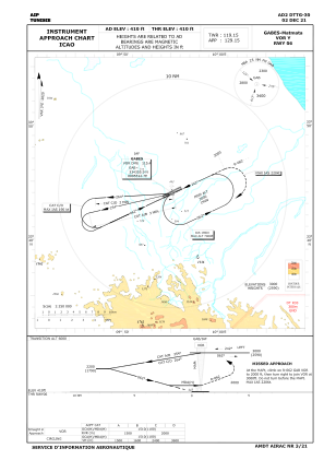
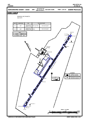


DTTG - Gabes/Matmata
Located in Gabes, Tunisia
ICAO - DTTG, IATA - GAE
Data provided by AirmateGeneral information
Coordinates: N33°43'57" E9°54'58"
Elevation is 410 feet MSL.
Magnetic variation is 3° East View others Airports in Gabès Governorate
Operational data
Special qualification required
Current time UTC:
Current local time:
Weather
METAR: DTTG 131400Z 08017KT 8000 FEW030 29/15 Q1016
TAF: TAF DTTG 131200Z 1313/1322 08015KT 8000 FEW030 PROB40 TEMPO 1316/1322 08022G32KT
Communications frequencies: [VIEW]
Runways:
| RWY identifier | QFU | Length (ft) | Width (ft) | Surface | LDA (ft) |
| 06 | 63° | 9869 | 148 | ASP | |
| 24 | 243° | 9869 | 148 | ASP |
Airport contact information
Address: Gabes Tunisia