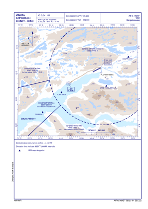
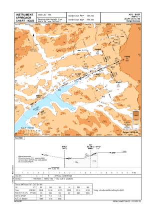
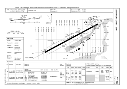


BGSF - Kangerlussuaq
Located in Kangerlussuaq, Greenland
ICAO - BGSF, IATA - SFJ
Data provided by AirmateGeneral information
Coordinates: N67°1'1" W50°41'22"
Elevation is 165 feet MSL.
Magnetic variation is -30° East View others Airports in (unassigned)
Operational data
Special qualification required
Current time UTC:
Current local time:
Weather
METAR: BGSF 170850Z AUTO 04005KT 360V060 9999NDV ///190/// 09/05 Q1003
TAF: TAF BGSF 170453Z 1709/1812 06008KT 9999 SCT200 BECMG 1715/1718 15012KT BKN060 TEMPO 1718/1724 7000 -RA BKN035 TEMPO 1800/1812 SCT060
Communications frequencies: [VIEW]
Runways:
| RWY identifier | QFU | Length (ft) | Width (ft) | Surface | LDA (ft) |
| 09 | 62° | 9219 | 197 | ASP | |
| 27 | 242° | 9219 | 197 | ASP |
Airport contact information
Address: Kangerlussuaq Greenland