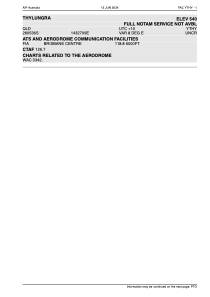


YTHY - Thylungra
Located in Eromanga, Australia
ICAO - YTHY, IATA - TYG
Data provided by AirmateGeneral information
Coordinates: S26°5'34" E143°27'5"
Elevation is 540 feet MSL.
Magnetic variation is 8° East View others Airports in Queensland
Operational data
Special qualification required
Current time UTC:
Current local time:
Weather at : - ( 0 km )
METAR: CYRQ 280957Z AUTO 18009KT 5SM RA BR SCT037 BKN048 BKN071 OVC090 10/09 A3002 RMK LTNG DIST ALQDS PRESFR PCPN 4.3MM PAST HR SLP169
Communications frequencies: [VIEW]
Runways:
| RWY identifier | QFU | Length (ft) | Width (ft) | Surface | LDA (ft) |
| 18 | 191° | 3543 | 0 | S | |
| 36 | 0° | 3543 | 0 | S | |
| 36 | 11° | 0 | 0 | UNK |
Airport contact information
Address: Eromanga Australia