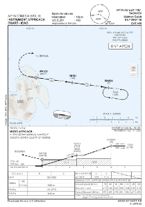
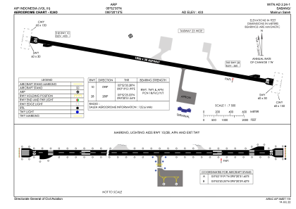


WITN - Sabang / Maimun Saleh
Located in Sabang, Indonesia
ICAO - , IATA - SBG
Data provided by AirmateGeneral information
Coordinates: N5°52'35" E95°20'15"
Elevation is 433 feet MSL.
View others Airports in Aceh
Operational data
Special qualification required
Current time UTC:
Current local time:
Weather at : WITT - Banda Aceh/Sultan Iskandar Muda ( 41 km )
TAF: TAF WITT 261100Z 2612/2712 15003KT 9999 SCT019 BECMG 2704/2706 32005KT
Communications frequencies: [VIEW]
Runways:
| RWY identifier | QFU | Length (ft) | Width (ft) | Surface | LDA (ft) |
| 10 | 98° | 6070 | 98 | UNK | |
| 28 | 278° | 6070 | 98 | UNK |
Airport contact information
Address: Sabang Indonesia