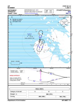
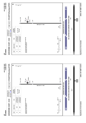


VYKP - Kyaukpyu
Located in Kyaukpyu, Myanmar
ICAO - VYKP, IATA - KYP
Data provided by AirmateGeneral information
Coordinates: N19°25'36" E93°32'5"
Elevation is 13 feet MSL.
View others Airports in Rakhine State
Operational data
Special qualification required
Current time UTC:
Current local time:
Weather at : - ( 0 km )
METAR: PAJZ 291406Z AUTO 18006KT 1 1/2SM BR OVC003 M03/M03 A3005 RMK AO2 FZRANO $
Communications frequencies: [VIEW]
Runways:
| RWY identifier | QFU | Length (ft) | Width (ft) | Surface | LDA (ft) |
| 18 | 180° | 7500 | 98 | BIT | |
| 36 | 360° | 7500 | 98 | BIT |
Airport contact information
Address: Kyaukpyu Myanmar