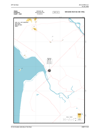
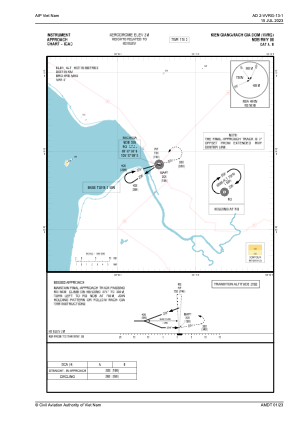
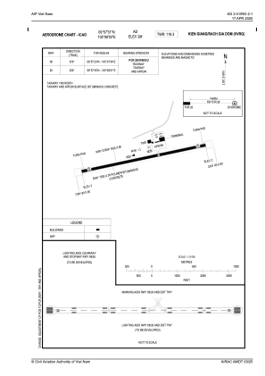


VVRG - Kien Giang/Rach Gia Domestic
Located in Rach Gia, Viet Nam
ICAO - VVRG, IATA - VKG
Data provided by AirmateGeneral information
Coordinates: N9°57'31" E105°8'3"
Elevation is 7 feet MSL.
View others Airports in Kien Giang
Operational data
Special qualification required
Current time UTC:
Current local time:
Weather at : VVCT - Can Tho/Can Tho International ( 65 km )
METAR: VVCT 020830Z VRB03KT 9999 SCT015 36/25 Q1004 NOSIG
TAF: TAF VVCT 020500Z 0206/0306 20007KT 9999 SCT015
Communications frequencies: [VIEW]
Runways:
| RWY identifier | QFU | Length (ft) | Width (ft) | Surface | LDA (ft) |
| 08 | 76° | 4921 | 98 | ASP | |
| 26 | 256° | 4921 | 98 | ASP |
Airport contact information
Address: Rach Gia Viet Nam