


VVNB - Aerodrome Ha Noi/Noi Bai International
Located in Ha Noi, Viet Nam
ICAO - VVNB, IATA - HAN
Data provided by AirmateGeneral information
Coordinates: N21°13'18" E105°48'20"
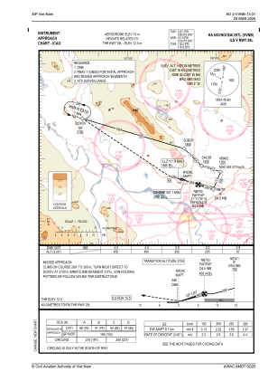
Elevation is 40 feet MSL.
View others Airports in Ha Tay
Operational data
Special qualification required
Current time UTC:
Current local time:
Weather
METAR: VVNB 070130Z 05007KT 9999 OVC018 26/24 Q1014 NOSIG
TAF: TAF VVNB 062300Z 0700/0724 08005KT 4000 BR SCT015 BECMG 0700/0702 6000 NSW TEMPO 0708/0711 4000 TSRA SCT012 FEW027CB TEMPO 0719/0724 4000 TSRA SCT012 FEW027CB
Communications frequencies: [VIEW]
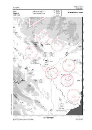
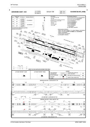
Runways:
| RWY identifier | QFU | Length (ft) | Width (ft) | Surface | LDA (ft) |
| 11L | 107° | 10499 | 148 | CON | |
| 29R | 287° | 10499 | 148 | CON | |
| 11R | 107° | 12467 | 148 | CON | |
| 29L | 287° | 12467 | 148 | CON |
Airport contact information
Address: Ha Noi Viet Nam