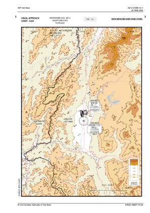
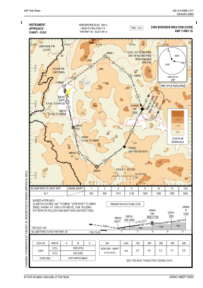
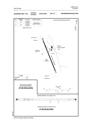


VVDB - Dien Bien Phu Airport
Located in Dien Bien Phu, Viet Nam
ICAO - VVDB, IATA - DIN
Data provided by AirmateGeneral information
Coordinates: N21°24'8" E103°0'2"
Elevation is 1591 feet MSL.
View others Airports in Lai Chau
Operational data
Special qualification required
Current time UTC:
Current local time:
Communications frequencies: [VIEW]
Runways:
| RWY identifier | QFU | Length (ft) | Width (ft) | Surface | LDA (ft) |
| 17 | 166° | 7874 | 148 | UNK | |
| 35 | 346° | 7874 | 148 | UNK |
Airport contact information
Address: Dien Bien Phu Viet Nam