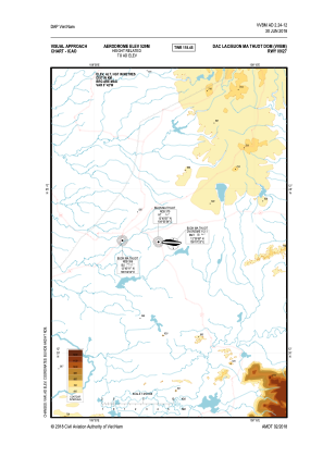
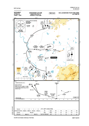
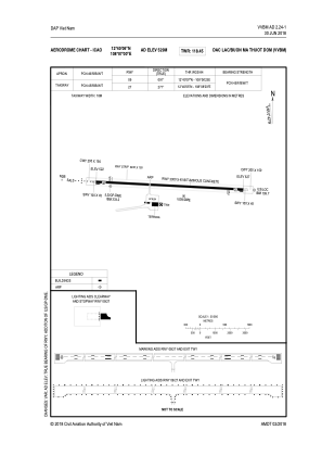


VVBM - Buon Ma Thuot Airport
Located in Buon Ma Thuot, Viet Nam
ICAO - VVBM, IATA - BMV
Data provided by AirmateGeneral information
Coordinates: N12°40'6" E108°7'0"
Elevation is 1739 feet MSL.
View others Airports in Dac Lac
Operational data
Special qualification required
Current time UTC:
Current local time:
Weather at : - ( 0 km )
METAR: LWOH 291250Z 18004KT 110V270 9999 FEW050 21/09 Q1021
Communications frequencies: [VIEW]
Runways:
| RWY identifier | QFU | Length (ft) | Width (ft) | Surface | LDA (ft) |
| 09 | 91° | 9843 | 148 | ASP | |
| 27 | 271° | 9843 | 148 | ASP |
Airport contact information
Address: Buon Ma Thuot Viet Nam