


VCBI - Bandaranaike International Airport Colombo
Located in Colombo, Sri Lanka
ICAO - VCBI, IATA - CMB
Data provided by AirmateGeneral information
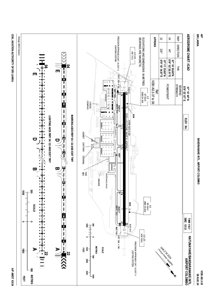
Coordinates: N7°10'49" E79°53'7"
Elevation is 29 feet MSL.
View others Airports in Western Province
Operational data
Special qualification required
Current time UTC:
Current local time:
Weather
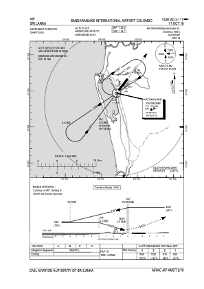
METAR: VCBI 301210Z 19008KT 9000 TS FEW010 BKN016 FEW018CB 27/26 Q1007 NOSIG RMK CB NE/E/SE/S/SW/W
TAF: TAF VCBI 301100Z 3012/0118 22006KT 9999 FEW017 FEW019CB TX34/0107Z TN25/0100Z PROB30 TEMPO 3012/3015 VRB20G30KT 7000 -TSRA/SHRA SCT016 FEW019CB BKN080 BECMG 3020/3022 VRB05KT
Communications frequencies: [VIEW]
Runways:
| RWY identifier | QFU | Length (ft) | Width (ft) | Surface | LDA (ft) |
| 04 | 38° | 10991 | 148 | ASP | |
| 22 | 218° | 10991 | 148 | ASP |
Airport contact information
Address: Colombo Sri Lanka