


VAMA - Mundra Airport, Mundra
Located in Mundra Bus Stand, India
ICAO - , IATA -
Data provided by AirmateGeneral information
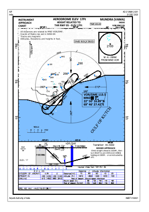
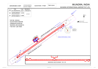
Coordinates: N22°50'7" E69°45'54"
Elevation is 17 feet MSL.
View others Airports in Gujarat
Operational data
Special qualification required
Current time UTC:
Current local time:
Communications frequencies: [VIEW]
Runways:
| RWY identifier | QFU | Length (ft) | Width (ft) | Surface | LDA (ft) |
| 05 | 55° | 6227 | 98 | UNK | |
| 23 | 235° | 6227 | 98 | UNK |
Airport contact information
Address: Mundra Bus Stand India