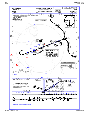
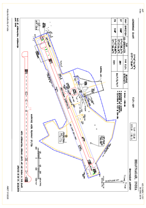


VABV - Bhavnagar Airport
Located in Bhavnagar, India
ICAO - VABV, IATA - BHU
Data provided by AirmateGeneral information
Coordinates: N21°45'16" E72°11'26"
Elevation is 44 feet MSL.
View others Airports in Gujarat
Operational data
Special qualification required
Current time UTC:
Current local time:
Weather
TAF: TAF VABV 290500Z 2906/2915 34008KT 6000 FEW025 BECMG 2907/2909 36005KT BECMG 2913/2915 24010KT 5000 FU NSC
Communications frequencies: [VIEW]
Runways:
| RWY identifier | QFU | Length (ft) | Width (ft) | Surface | LDA (ft) |
| 07 | 68° | 6302 | 148 | ASP | |
| 25 | 248° | 6302 | 148 | ASP |
Airport contact information
Address: Bhavnagar India