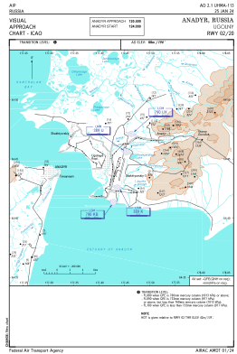
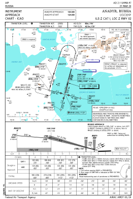
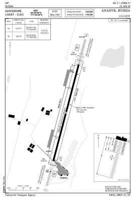


UHMA - Anadyr/Ugolny
Located in Anadyr, Russian Federation
ICAO - UHMA, IATA - DYR
Data provided by AirmateGeneral information
Coordinates: N64°44'6" E177°44'30"
Elevation is 194 feet MSL.
View others Airports in Chukotka Autonomous Okrug
Operational data
Special qualification required
Current time UTC:
Current local time:
Weather
METAR: UHMA 032200Z 01009MPS CAVOK M03/M09 Q1017 R02/////// NOSIG RMK MID 02011G15MPS END R02/02012G15MPS QFE759/1012
TAF: TAF UHMA 031951Z 0321/0421 36009G14MPS 9999 SCT033 TEMPO 0321/0412 03014G19MPS TEMPO 0412/0421 34003G08MPS BKN017
Communications frequencies: [VIEW]
Runways:
| RWY identifier | QFU | Length (ft) | Width (ft) | Surface | LDA (ft) |
| 02 | 15° | 11483 | 197 | UNK | |
| 20 | 195° | 11483 | 197 | UNK |
Airport contact information
Address: Anadyr Russian Federation