


UHKD - Komsomolsk-Na-Amure/Dzemgi
Located in Komsomolsk-Na-Amure, Russian Federation
ICAO - UHKD, IATA -
Data provided by AirmateGeneral information
Coordinates: N50°36'20" E137°4'53"
Elevation is 82 feet MSL.
View others Airports in Khabarovsk Krai
Operational data
Special qualification required
Current time UTC:
Current local time:
Weather at : - ( 0 km )
METAR: ZMCK 280930Z 34006MPS 9999 FEW033 08/M11 Q1019 NOSIG
Communications frequencies: [VIEW]
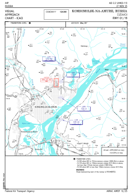
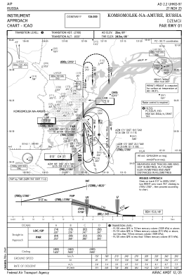
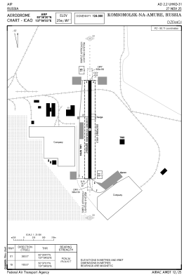
Runways:
| RWY identifier | QFU | Length (ft) | Width (ft) | Surface | LDA (ft) |
| 01 | 360° | 8097 | 262 | UNK | |
| 19 | 180° | 8097 | 262 | UNK |
Airport contact information
Address: Komsomolsk-Na-Amure Russian Federation