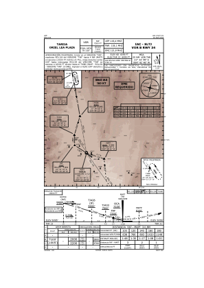
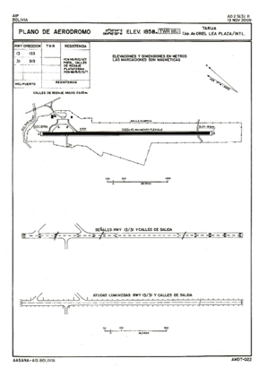


SLTJ - Cap. Av. Oriel Lea Plaza
Located in Tarija, Bolivia
ICAO - SLTJ, IATA - TJA
Data provided by AirmateGeneral information
Coordinates: S21°33'14" W64°42'11"
Elevation is 6095 feet MSL.
View others Airports in Tarija
Operational data
Special qualification required
Current time UTC:
Current local time:
Weather
TAF: TAF SLTJ 280400Z 2806/2906 00000KT 9999 SCT025 SCT070 TX29/2819Z TN14/2810Z BECMG 2815/2817 14010KT FEW027 BECMG 2823/2901 00000KT SCT025
Communications frequencies: [VIEW]
Runways:
| RWY identifier | QFU | Length (ft) | Width (ft) | Surface | LDA (ft) |
| 13 | 125° | 9951 | 148 | ASP | |
| 31 | 305° | 9951 | 148 | ASP |
Airport contact information
Address: Tarija Bolivia